A little piece of Hampshire history
A path through
our shared history.
Discover the peaceful rural footpath linking Hook and Newnham — a familiar local walk with a story reaching back through generations.
Explore Church PathA route with a story to tell
A walk through centuries of local history
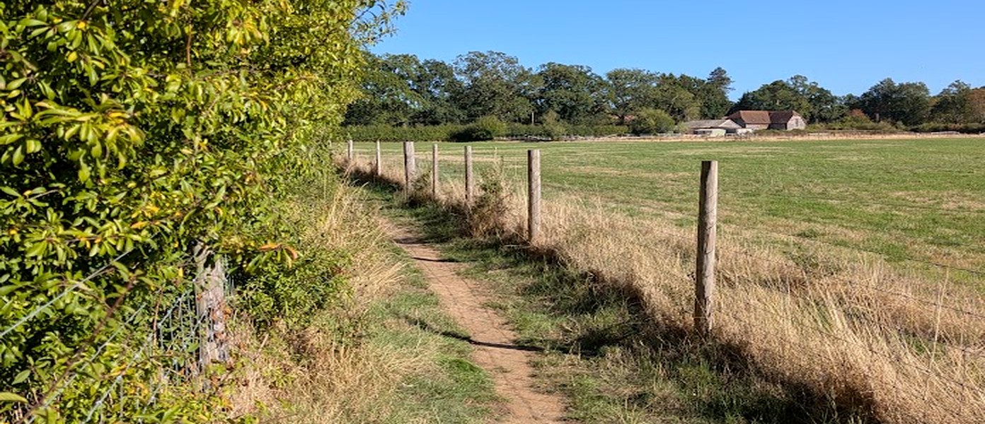
Church Path is a short rural footpath linking Hook and Newnham. It crosses open farmland and follows old field boundaries — but its name tells a deeper story about how the two communities were connected.
Why is it called Church Path?
At first, the name may seem unusual: within Hook, the path does not lead to St John’s Church. The explanation lies in the history of the parish. Much of what is now Hook once belonged to Newnham parish, and people from this area would have walked to St Nicholas’ Church in Newnham for Sunday worship. Church attendance was expected each Sunday in medieval times and continued to be expected after Henry VIII’s break with Rome in 1534.
St Nicholas’ Church is recorded as existing by around 1125–1135. It still stands today, with its Norman chancel arch and other ancient features. Church Path joins Hook Footpath No. 25 directly to Newnham Footpath No. 3; together they form the route signed in both communities.
We cannot know precisely when the route was first labelled “Church Path”. The Friends of Church Path historical study suggests the name may have been in use for around 880 years or more, perhaps longer if an earlier church stood on the site. The study describes it as possibly the district’s oldest identifiable pedestrian path — a valuable piece of rural heritage.
This interpretation comes from the Friends of Church Path study, Church Path, Hook to Newnham: An Irreplaceable Heritage Asset (January 2020), and local notes supplied by the group. The estimated age of the name is not a proven date.
The classic route
Hook to Newnham — and back again
At around 1.2 km each way, Church Path is a short rural walk with open views, old hedgerows and a remarkable connection to St Nicholas’ Church.
A longer local adventure
Hook – Newnham – Rotherwick: a circular walk
A local walk guide describes a lovely 4.6-mile circular route through the countryside around Hook, Newnham and Rotherwick. It includes Church Path, St Nicholas’ Church, rural lanes, fields, woodland and village landmarks.
Highlights along the way
- Great Sheldon’s Coppice — one of the suggested starting points.
- Church Path — the historic route used by Hook residents travelling to St Nicholas’ Church.
- Newnham Green and St Nicholas’ Church — the historic heart of the route.
- Tylney Hall and Rotherwick — woodland paths, the golf-course footpath, village pond and local landmarks.
- The Brenda Parker Way — part of the route follows this longer-distance path.
The guide recommends good walking shoes or boots, and wellingtons in winter or after prolonged rain. Take care on the plank bridge at Newnham Brook, which may be slippery, and where the right of way crosses golf fairways.
The route is marked in red. Numbered labels identify key entry points and landmarks. Select the map to view it larger.
Walk details and map reproduced from the supplied four-page “Hook – Newnham – Rotherwick. A Circular Walk” guide. Please check that the author is happy for the guide and map to be shared publicly before publishing.
Traces through time
Following the path through history
The Church Path study follows the route through historic maps, including an estate map from 1616 and the 1842 Newnham Tithe Map, which records the name “Footpath Close”. The 1877 Ordnance Survey map offers another view of the route through the landscape.
A path that remembers the landscape
The local notes say that, as Church Path crosses the large field in Newnham west of the parish boundary, the route is never ploughed. Once it reaches Newnham Green, a raised surface is still visible. It is thought that this raised section helped keep the path from becoming too muddy — a practical trace of its long use.
The same path, a different world
Church Path through the seasons
From leafy summer shade to a rare snowy walk, these photographs show how familiar places change with the weather and the time of year.
See it for yourself
Church Path in pictures
A selection of views along the path, its surroundings, the signs at either end and the people who care about this special local route. Select any picture to open a larger view.
About the group
Friends of Church Path
Friends of Church Path brings together people who value the history, countryside and everyday enjoyment of this route between Hook and Newnham. This website shares its story, helps people find the path and encourages more people to explore it.
Questions or local memories to share? friendsofchurchpath@hotmail.com